
Griffin ZIP Coverage at a Glance
Griffin has two principal city-name ZIP codes. Both extend beyond the municipal footprint into the wider Spalding County delivery area. The descriptions below are broad orientation, not street-level boundary findings. USPS should confirm a specific delivery address, and county GIS should answer whether the parcel lies inside Griffin.
| ZIP | General Area | Post Office | Key Note |
|---|---|---|---|
| 30223 | North, central, and east Griffin plus surrounding Spalding territory | Griffin facilities; verify the exact station with USPS | Includes addresses outside Griffin city limits |
| 30224 | South and west Griffin plus surrounding Spalding territory | Griffin facilities; verify by exact address | Crosses planning and tax jurisdictions |
The main Griffin Post Office is at 101 N. 8th Street, 30223-9998, with phone service at 770-412-8840. Published retail hours are 8:30 a.m. to 5 p.m. weekdays and 8:30 a.m. to noon Saturday. USPS also lists nearby Experiment 30212, Orchard Hill 30266, and Sunny Side 30284. Those community ZIPs should not be added to Griffin's principal two-code table merely because they are close.
Verify a Griffin ZIP Address
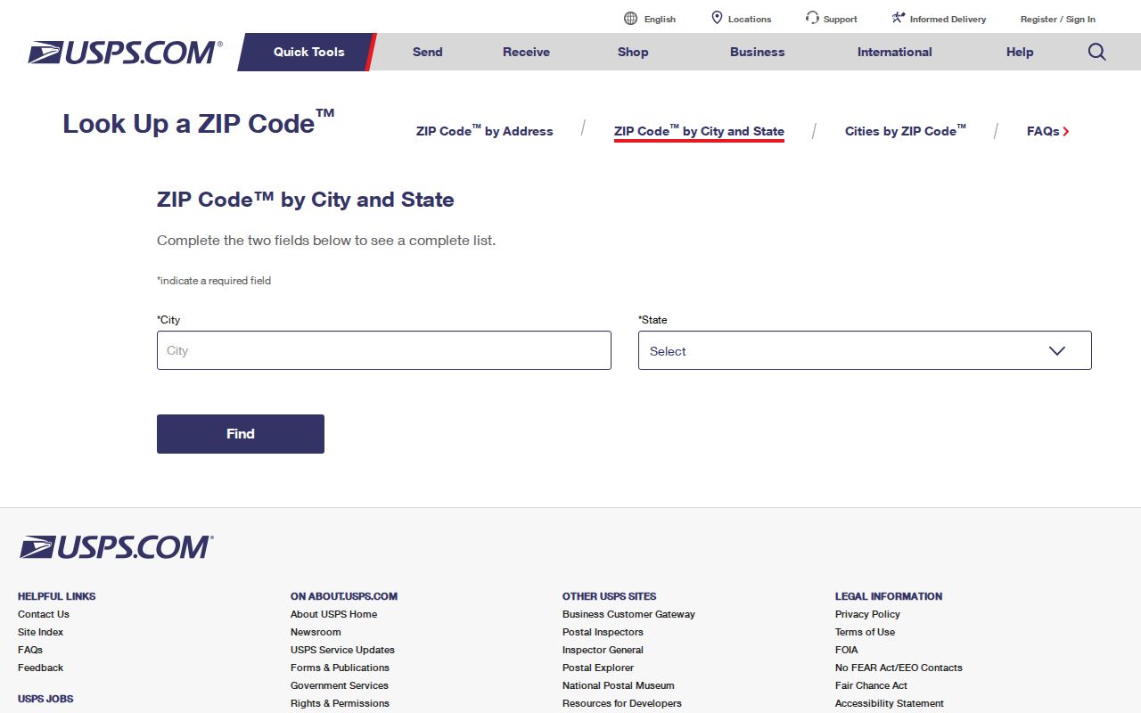
The USPS ZIP Code Lookup is the official first stop for a current mailing address. Search by street address when possible. A city-and-state search can show ZIPs associated with Griffin, but only the full address result confirms the postal form and ZIP+4 for one delivery point.
The image below shows the captured USPS lookup interface used for Griffin postal research. It matters because the tool validates postal routing, while county databases answer ownership and jurisdiction questions.
Copy the standardized address exactly, including directional prefixes, street suffix, unit, and ZIP+4. Then compare that address with the parcel's situs field. A mismatch may reflect a formatting difference, a unit problem, or a tax mailing address that belongs to the owner instead of the property.
Griffin Mail Is Not Jurisdiction
A “Griffin, GA” mailing line does not establish that land is inside the City of Griffin. ZIP boundaries are designed for mail delivery. They can cross city borders, tax districts, planning areas, voting precincts, and school zones. Annexation may also change city services or taxes without changing a familiar mailing label.
This is the central myth to avoid in a Griffin ZIP code directory. For municipal jurisdiction, inspect the parcel in Spalding County GIS and confirm with Griffin Planning or county Community Development when the line is unclear. For a precinct, use elections data. For school assignment, use the responsible school system's current finder. The postal city alone cannot answer those questions.
Boundary check. Treat a Griffin ZIP as a mail route, then use the official parcel or district system for legal geography.
Find Griffin Residents by ZIP
Neither Griffin ZIP code produces a complete official resident list. qPublic is keyed to parcels, owners, situs addresses, and tax mail, while Georgia My Voter Page verifies one voter's record through identifying inputs. The research session could not confirm a ZIP-wide filter in qPublic or a ZIP polygon layer in the county map. Do not promise either feature.
- Verify the exact address and ZIP through USPS. This avoids searching a nearby community code as though it were one of Griffin's principal codes.
- Search the Spalding qPublic property index by the street address or owner. Keep situs and tax mailing fields separate.
- Open the Spalding parcel map when city jurisdiction or nearby parcels matter. Use parcel boundaries, not an assumed postal outline.
- Use Georgia My Voter Page only to verify an individual voter when the required identity inputs are known. It is not a ZIP-browse tool.
- After narrowing the result to a road, follow the Griffin by-street search for parcel and address-level work.
This route answers different questions in order: postal correctness, parcel identity, mapped jurisdiction, and an authorized voter check. It is slower than downloading a supposed ZIP list, but it avoids claiming that property owners, voters, and occupants are the same group.
Read Griffin Address Fields
Property systems use three address concepts that can send a ZIP search in different directions. The distinction is especially important in Griffin because a county parcel may carry a Griffin postal city while sitting beyond the municipal line.
| Field | Meaning | Search Value |
|---|---|---|
| Situs address | The physical location assigned to the parcel | Best starting point for a property search |
| Tax mailing address | Where owner correspondence is sent | A locate clue, not proof of occupancy |
| Legal description | Lot, block, subdivision, or metes-and-bounds description in deeds | Stable link when street wording changes |
Search-field details on the live qPublic advanced page were not available during research, so ZIP capability remains unverified. The safe published workflow is address or owner search, followed by parcel inspection. If a portal offers a ZIP filter when visited, treat the result as parcels matching that stored field, not as a roster of Griffin residents.
Griffin ZIP and Voter Records
The Georgia My Voter Page requires first initial, last name, county, and date of birth. A match can show registration status, county, precinct, polling place, political districts, and election services. ZIP is not an input. The tool is meant to verify one person's record, not browse all voters in 30223 or 30224.
A full voter file is a separate order through the Secretary of State. Published fields include residence street details and ZIP, along with precinct and district fields, but exclude telephone, full date of birth, Social Security number, and driver's-license number. Georgia bars commercial use under O.C.G.A. §§21-2-225 and 21-2-601. Orders are prepaid and typically processed in two weeks.
The Spalding Board of Elections and Voter Registration, at 825 Memorial Drive, Griffin, administers the county and city election layer. The successful capture below shows that official local access point.

Inactive voter status is not proof that someone left a Griffin ZIP or one street address. It can reflect list-maintenance steps. Read voter data as a dated registration clue and confirm it with the office when accuracy matters.
Griffin ZIP Areas Are Broad
Census ZIP Code Tabulation Area measurements show why a Griffin postal label is too broad for neighborhood claims. ZCTA 30223 covers 108.054 land square miles, and 30224 covers 66.135. Both generalized statistical areas are far larger than Griffin's roughly 13.9 square miles. ZCTAs approximate postal geography for statistics; they are not the live USPS route database.
Those numbers explain why both principal ZIPs sweep in surrounding Spalding County territory. They do not provide named-neighborhood boundaries, and no authoritative source in the research documented a dated Griffin ZIP split, a PO-box-only ZIP, or a unique institutional ZIP. Omitting those claims is more accurate than filling a standard directory table with guesses.
Griffin's postal reach also reflects the city's place within a larger county-seat region south of metropolitan Atlanta. Local records divide the same landscape in other ways. The county assessor follows parcels and legal descriptions, the elections office follows precincts and political districts, and municipal departments follow the city boundary. A single 30223 or 30224 result may therefore point to several different custodians. When an address sits near an apparent service line, record the parcel number before calling an office. That stable identifier helps staff distinguish a county delivery address from a parcel actually governed by Griffin. It also prevents a broad ZCTA statistic from being mistaken for a count of city residents.
For demographic context, use the Census QuickFacts city profile. Do not substitute ZCTA totals for city totals. The geographic units answer different questions.
Trace Older Griffin ZIP Addresses
ZIP codes cannot carry a Griffin address back before modern postal routing. Historical work instead uses plats, parcel legal descriptions, cross streets, city directories, and Sanborn fire-insurance maps. No verified citywide Griffin renumbering timeline was located, so an old street number should not be converted by assumption.
Begin with the current parcel and legal description. Compare the lot and block to recorded plats, then use directory street sections and map sheets to test the old address. A legal description often stays useful when street names or postal forms change. The Spalding County Clerk holds recorded instruments and plats; historical directory and map collections add occupant and building context.
Note: For an old Griffin address, parcel identity and cross streets are stronger bridges than forcing a modern ZIP onto the record.
Griffin ZIP Directory Limits
A ZIP code directory can organize a search, but it cannot prove city residency, occupancy, parcel ownership, precinct, school assignment, or service area. Each conclusion belongs to its own current official system. Use USPS for delivery, qPublic for property, GIS for parcel geography, and elections records for voting districts.
- ZIP and ZIP+4
- A five-digit delivery area and its four-digit segment for a smaller delivery group.
- PO-box ZIP
- A code or routing use tied to post-office boxes rather than ordinary street delivery; none was confirmed for Griffin.
- Unique ZIP
- A ZIP assigned to one high-volume institution; none was confirmed in the Griffin research.
- Carrier route
- The set of delivery points assigned to one postal route, which is not a city or precinct boundary.
The strongest Griffin ZIP code directory result is a properly scoped one. Confirm the mailing code, identify the parcel, then move to the office that owns the next fact. That method respects the limits of 30223 and 30224 while still making them useful search filters.